Tour du Mont Blanc
Les Contamines to Courmayeur · France into Italy
The best-known trek in the Alps, and you would be walking its finest section — over two high passes and across a border on foot, from French mountain refuges to an Italian valley where dinner is a completely different proposition. Everyone has heard of this one. That counts for something when you are selling a trip.
- Nights
- 4 nights in mountain refuges
- Total distance
- 48.6 km / 30 mi
- Total ascent
- 2,952 m / 9,685 ft
- Highest point
- 2,516 m — Col de la Seigne
What you'd be looking at
Day by day
Les Contamines → Refuge Nant Borrant
Gentle startA deliberately short first afternoon up the Val Montjoie, on a Roman road past the baroque chapel of Notre-Dame de la Gorge. A free shuttle from the village saves an hour and a half if you want it. Arrive early, eat well, sleep at the head of the valley.
- Distance
- 5.7 km
- Ascent
- +327 m
- Descent
- −28 m
- On foot
- 1–2 h adults · 2–3 h kids
→ Refuge de la Croix du Bonhomme
The hardest day of any route hereTwo passes in one morning, Col du Bonhomme then Col de la Croix du Bonhomme, and a kilometre of vertical gain with nowhere to buy food. Snow often lies on the col into early July. The refuge at 2,443 m is basic and the view from its doorstep is enormous. This day decides whether this route is right for your group.
- Distance
- 8.2 km
- Ascent
- +1,048 m
- Descent
- −60 m
- On foot
- 3–4 h adults · up to 7 h kids
→ Les Chapieux → Refuge les Mottets
Long descentA thousand metres down to Les Chapieux, where there is an inn for lunch and a shuttle bus if legs are finished. Then an easy valley walk past a working farm that makes Beaufort cheese — worth the detour, and the sort of stop that resets a tired eight-year-old.
- Distance
- 11.1 km
- Ascent
- +350 m
- Descent
- −928 m
- On foot
- 2–3 h adults · up to 7 h kids
→ Col de la Seigne → Rifugio Elisabetta
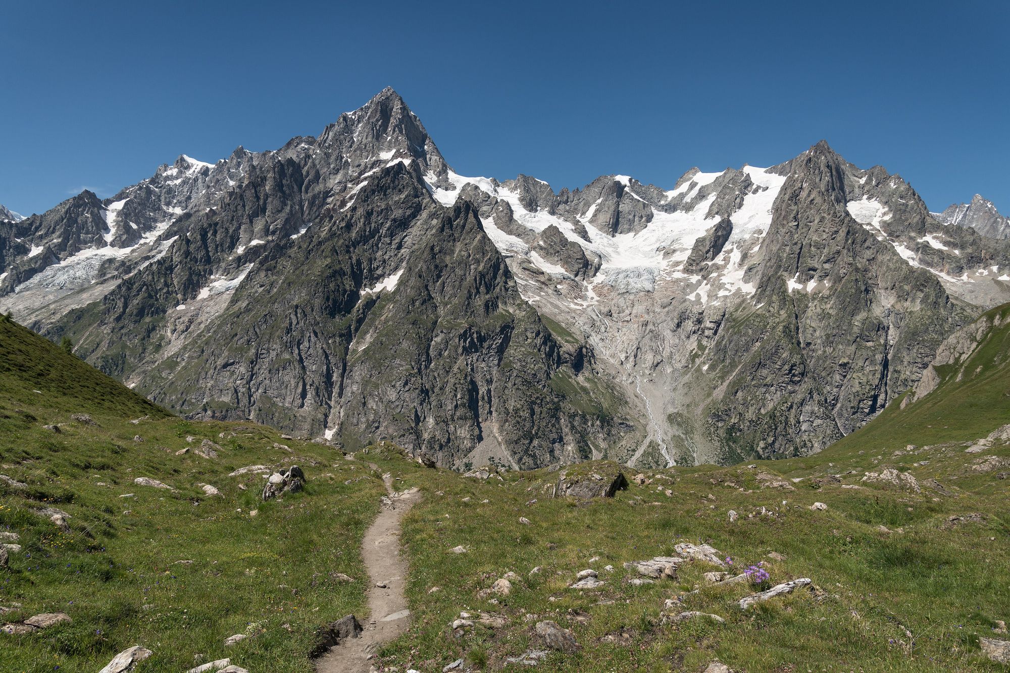
The border dayUp to Col de la Seigne at 2,516 m, where you step out of France into Italy and the entire south side of the Mont Blanc massif appears at once — glaciers, the Aiguille des Glaciers, the whole wall of it. Every account of this walk agrees this is the moment. Dinner that night is Italian.
- Distance
- 7.9 km
- Ascent
- +687 m
- Descent
- −367 m
- On foot
- 3–4 h
Val Veny → Courmayeur
Downhill finishDown the Val Veny with Mont Blanc over your shoulder the whole way. Take the Maison Vieille chairlift and the Dolonne cable car to cut two hours and a lot of knee, and be in Courmayeur in time for a long Italian lunch.
- Distance
- 15.7 km
- Ascent
- +540 m
- Descent
- −1,532 m
- On foot
- 4–5 h, or 2–3 h with lifts
The honest part
The hardest bit
Day 2, without question. A guide written specifically for families walking this route puts it at up to seven hours for children, with 1,048 m of climbing and no lunch stop. It is the single biggest ask on any of these four routes.
If someone's had enough
A shuttle bus serves Les Chapieux on day 3, and another runs from Les Contamines on day 1. Day 2 has no road and no lift — once you start up the Bonhomme you are committed, which is the honest thing to know about this route.
Where you sleep
Mountain refuges throughout, mostly dormitory bunks with shared washrooms, half board included. Comfortable in the way a good hut is comfortable — hot food, a drying room, other walkers — but nobody gets a private bathroom. This is the most rustic of the four.
Fitting twenty-one people
Refuges on the Tour du Mont Blanc are small and book out very early. Twenty-one places on four consecutive nights is a real constraint and may need splitting across neighbouring refuges.
Getting there
Geneva (GVA) — 1h15 by road to Les Contamines
When to book
Refuge bookings for the following summer typically open in the winter and the popular ones go quickly. Treat early 2028 as the deadline and have the decision made in 2027.
Days either side
Courmayeur at the end, then the Skyway cable car to 3,466 m, or a day on the balcony path to Rifugio Bertone for the Grandes Jorasses. A bus through the Mont Blanc tunnel puts you in Chamonix in under an hour.
What everyone thinks of Tour du Mont Blanc
No comments yetSay what you actually think about this one — no need to be diplomatic. Everyone can see these.